Every boat owner should be intimately familiar with how to read the wind and forecast the weather. True, you can listen to any meteorological report and pick up the basics for the day, but if you know how to read the wind on the fly, you'll be in a much better position to navigate on the water and avoid dangerous situations. If you’re into sailing, this is an even more important dynamic to learn.
How do you read the wind and weather before and during your boating trip?
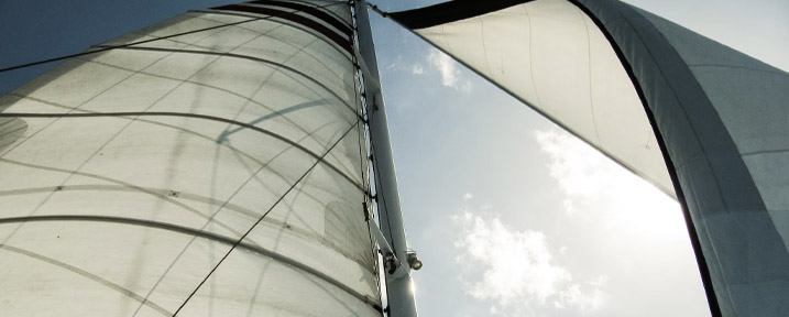
How Wind Works
Wind and air movements are disproportionately responsible for the majority of weather phenomena that we see. But what exactly is wind and how does it work?
Wind is a mass of air that has approximately the same temperature and humidity throughout. Horizontally, this mass of air can spread out over thousands of kilometres, and it moves in a specific direction.
What exactly moves this air? There is no secret invisible force that pushes the air around. Instead, movement is typically a byproduct of temperature and pressure.
Temperature and pressure are highly related; when the temperature of a given area increases, the energy of that area increases, with particles moving more rapidly and further apart. In fact, we can even say that temperature is a direct measure of how these particles are moving. In areas with high temperatures, pressure tends to increase because of this high intensity. In areas with low temperatures, pressure tends to decrease because of lower intensity and higher density.
Air always moves from areas of higher pressure to areas of lower pressure to reach homeostasis. Thus, when there are high-pressure and low-pressure air masses near each other, high-pressure air moves to the low-pressure area, resulting in the phenomenon known as wind.
Wind Velocity and Direction
Wind velocity can be measured in a variety of different ways. Generally, wind velocity is measured at a distance about 10 to 12 metres above the surface of the earth. Oftentimes, wind velocity is measured in terms of metres per second; you can also convert this into knots by multiplying this value by two. You may also see wind velocity measured in terms of the Beaufort wind scale; in this scale, 0 is a measure of a perfectly calm sea, while 12 is a measure of hurricane-force winds.
You'll also need to know the direction of the wind. Wind direction refers to the source of the wind; for example, a wind blowing north to south is considered a north wind. 0 degrees and 360 degrees correspond to north (with 0 degrees indicating no wind). 90 degrees corresponds to east. 180 degrees corresponds to south. 270 degrees corresponds to west.
The Isobar Map
You'll often see weather presented on what's called an isobar map. This type of map uses a series of lines to indicate pressure called isobars; these pressure lines indicate points on the map that have the same atmospheric pressure.
Predictably, air tends to move in the direction of high pressure to low pressure, using the shortest possible path. This air movement is indicated on an isobar map with a perpendicular line, called a normal line. The greater the pressure differential between two areas, the faster the wind is going to travel. Other forces, like friction, may modify the direction of the wind or decrease its speed.
Live wind maps may also be available. With time, you'll be able to read isobar maps and live wind maps with confidence, assessing where and how the wind is blowing, but also predicting how that may change in the near future. Weather is a complicated phenomenon that depends on an unfathomably large number of variables, so it's practically impossible to predict how the wind is going to change in the distant future.
Warm Fronts and Cold Fronts
Air masses of different temperatures can sometimes clash with each other. This area, where two different air masses combined, is called a front. Remember, temperature is associated with density; this means that low temperature, high density air tends to be lower in the atmosphere, while high temperature, low density air tends to be higher. When two different air masses come into contact with each other, one air mass slips over or under the other.
Fronts are called warm fronts or cold fronts, depending on whether the warm air or cool air comes forward. In a warm front, the warm air mass is cooled as a result of interacting with nearby cold air, and in a cold front, cold air heats up as a result of interacting with nearby warm air. In an occluded front, a fast-moving cold air mass collides directly with a slower warm air mass.
Fronts can move and collide in a variety of different ways, and these variables can lead to a variety of different weather effects. But in most cases, whenever a front exists, you can expect significant changes in weather and precipitation.
Clouds and Weather
It's also possible to make judgments about the weather based on the clouds you see in the sky. There are innumerable shapes of clouds, all of which have different features, but there are three that you need to pay close attention to as a boater:
- Nimbostratus. Nimbostratus clouds tend to be thick, dark grey clouds that make the sky dark. These are stereotypically “bad weather clouds,” and even people who are totally unfamiliar with meteorology can identify them as a sign that a storm is coming. These clouds typically produce moderate intensity showers that last 10 hours or longer.
- Stratus. Stratus clouds are thinner, resembling a dark fog that allows sunlight to pass through, to an extent. They tend to produce milder precipitation than nimbostratus clouds, but they still warrant your attention.
- Cumulonimbus. Cumulonimbus clouds are known as thunder clouds, and they tend to accumulate in large, lumpy shapes. Cumulonimbus clouds could be a sign of short, yet very heavy rainfall and unexpected changes to wind direction.
The better you understand climate and weather, and the closer you read the weather forecasts, the better you'll be able to plan for your boating expeditions and the better you'll be able to navigate on the water. Listening to a meteorologist can equip you with the basic knowledge you need to remain safe, but if the weather changes unexpectedly when you're on the water, you won't be able to rely on anything but your own assessments.
In this article, we've covered only the most basic elements of evaluating the wind and weather. You'll need to advance your knowledge further if you want to consider yourself a true adept in this area. In the meantime, you can shop for a boat that can withstand even inclement weather. Start browsing our deep collection of new and used vessels for sale today!