Named after the Celtic goddess Sionna, (who was drowned in the river and carried out to sea), the River Shannon divides the west of Ireland from the east and south, flowing generally southwards from the Shannon Pot, a small pool on the slopes of the Cuilcagh Mountain in County Cavan before eventually turning west to empty itself into the Atlantic Ocean through the Shannon Estuary at Limerick. At 224 miles long it is Ireland’s longest river, flowing along its present course since the end of the last glacial period.
Its history
When the Vikings settled in the region in the 10th century, they used the river to raid rich monasteries inland and by the 17th century the river was of major strategic importance in military campaigns, forming a physical boundary between the east and the west. It is also closely bound up with Ireland’s social, cultural, economic and political history.
Having a fall of only 18m in the first 140 miles, the northern end of the river has always been shallow, with a depth of only 0.5m in some places. The first attempt to improve this was in 1755, when Thomas Omer, a new immigrant from England, was commissioned to install lateral canals and pound or flash locks. He also created the first Jamestown Canal which cut out a loop of the river. The lower Shannon was a different story, falling by 30m in 12 miles. From 1757 onwards work was done to built lateral canals and locks, but in 1791 William Chapman was brought in to advise and discovered that the locks had been built to different specifications. He spent three years rebuilding most of them, before the navigation was finally opened in 1799, when corn, slates and turf were transported down to Limerick. Even then there were no tow paths on the river sections, there were sometimes shoals in the summer months and there were no harbour facilities in Limerick. Boats were limited to 15-20 ton loads or less.
By the early 19th century much repair work and improvements were necessary, which resulted in a dramatic increase of trade by the latter part of the 1820s and by 1831 14,600 passengers and 36,000 tons of freight were being carried. This put extra pressure on the navigation and saw 15 years of improvements, but when the railway opened, from Dublin to Limerick, both freight and passenger numbers dwindled. There had always been problems with flooding and these were not addressed until the 20th century. But traffic was still falling and in the 1950s, when it was suggested that low fixed bridges should replace opening bridges, the Inland Waterways Association of Ireland encouraged passenger launches to use the waterway, which kept the bridges high enough for navigation. Since then the leisure trade has steadily increased and become a true success story, although there is still a small amount of industry along the waterway, including a hydroelectric generation plant at Ardnacrusha, a tanker terminal at Foynes, an oil jetty at Shannon Airport, an alumina extraction plant at Aughinish Island and a coal-fired power station at Moneypoint. The lack of intensive industry and sparsely populated towns makes for a healthy river with minimal pollution, well stocked with fish such as Trout, Salmon, Bream and Pike. The areas that surround the river are a haven for wildlife and outdoor activities such as cruises, hill walking, cycling, horse riding, fishing and a host of water sports.
Cruising the waterway
There are many hire companies renting out boats along the length of the river and its canals, but if you are a boat owner you will probably need a berth in a private marina. For short visits boats are allowed to stay at public harbours: up to five days at a time and seven days in a month at any particular harbour. Occasionally it is possible leave a boat there over the winter. Sometimes hire firms allow private owners to stay for short periods if they have the room and private marinas may allow short-term stays by prior arrangement.
The route
The river first appears as a trout stream, before linking with a number of tributaries and flowing into Lough Allen, a large scenic lake with few facilities, which can get rough in strong northerly winds. At Drunshanbo the river leaves Lough Allen and continues towards Battlebridge and Leitrim. Small boats can use the narrow canal on this stretch and there is an interesting lock at Drumshanbo which can be either up or down, depending on the water levels in Lough Allen.
Downriver is the best-known of all the towns on the river, Carrick-on-Shannon, an attractive place with plentiful moorings and plenty to do. A few miles further on we come to Jamestown and Drumsna where the river runs faster and is by-passed by the Albert Canal and the Albert Lock.
Ireland’s Holy Grail
Now the river opens out into the three loughs of Tap, Bodero and Bofin, before narrowing again at Roosky which has a lift bridge and a lock. Continuing down towards Lough Forbes and Tarmonbarry, there is another lift bridge, a lock and another narrower section of river, flowing through typical Irish bogland – flat and marshy. Here we find the twin villages of Lainsborough and Ballyleague, one on either side of the river, before reaching the large lake of Lough Ree. Its shallow depth makes it difficult to navigate even though it is well marked. There are few harbours here until the southern part of the lake where you can moor up at Hodson Bay on the west shore or Glasson on the east. At the southern end of the lake the river narrows again and flows through Athlone, the largest town on the Shannon, well served with shops, restaurants and bars.
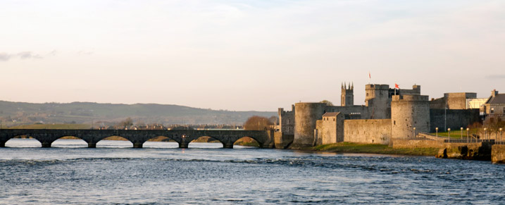
Leaving Athlone another lock brings us to a wider, deeper, slow running part of the river, which takes us past Clonmacnoise, Shannonbridge, Meelick, where there is another lock, and eventually to Portumna at the northern end of Loug Derg. Here there is some spectacular scenery, with hills sweeping down to the water’s edge, and several lovely harbours, including Terryglass, Dromineer, Garrykennedy and Mountshannon. The southern part of the lake starts to narrow as it reaches Scarriff and runs down to the twin towns of Ballina and Killaloe. Here the bridge marks the end of navigation for most boats. Those that do press on further will find dramatic scenery as they go towards the Hydro-electric Power Station at Ardnacrusha. The lock there is navigable but with a drop of over 100 feet (30m) not many attempt it. The Shannon finally reaches Limerick city before gradually widening to form an estuary and merging into the Atlantic Ocean. The estuary is surrounded by several rocky headlands, points and coves and long sandy beaches. It is important zoologically for several species of marine mammals including Bottle-nosed Dolphins.
Canals of the Shannon
There are many canals linking with the River Shannon. The Shannon-Erne Waterway, at the northern end, links it to the River Erne and Lough Erne, while the Royal and Grand Canals further south connect to Dublin and the Irish Sea. The River Suck and its canal, which joins the river near Shannonbridge, link it with Ballinasloe, while Boyle is connected via the Boyle canal, the River Boyle and Lough Kee. At the southern end is the Ardnacrusha canal connected with the Ardnacusha dam, south of Lough Derg, and near Limerick a short canal connecting Plassey with the Abbey River allows boats to bypass the Curraghower Falls. Other stretches of canal are the Lecarrow, leading to County Roscommon and the Jamestown canal forming a link to Lough Nanoge, south of Drumsna.
Referred to sometimes as “Ireland’s Holy Grail”, the River Shannon is certainly worth exploring if you wish to taste the magic and folk lore of Ireland.
Author – Dee White